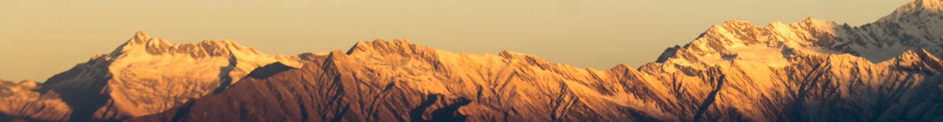
Pushpagiri also referred to as KumaraParvatha is the second highest peak in Coorg and the fourth highest peak in Karnataka. It is a part of the Western Ghats in the Somwarpet taluk of Coorg ditrict.
It is 6 km away from Kukke Subramanya which is a small temple town 230 kms from Bangalore. It is a very pristine pilgrimage place in Karnataka.
About the Trail:
Phase I: From temple to Bhattara Mane (5.2 kms, 3-4 hrs)
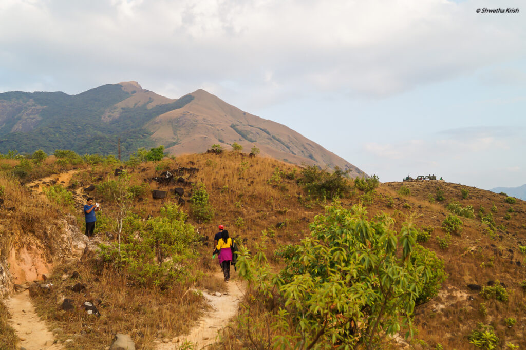
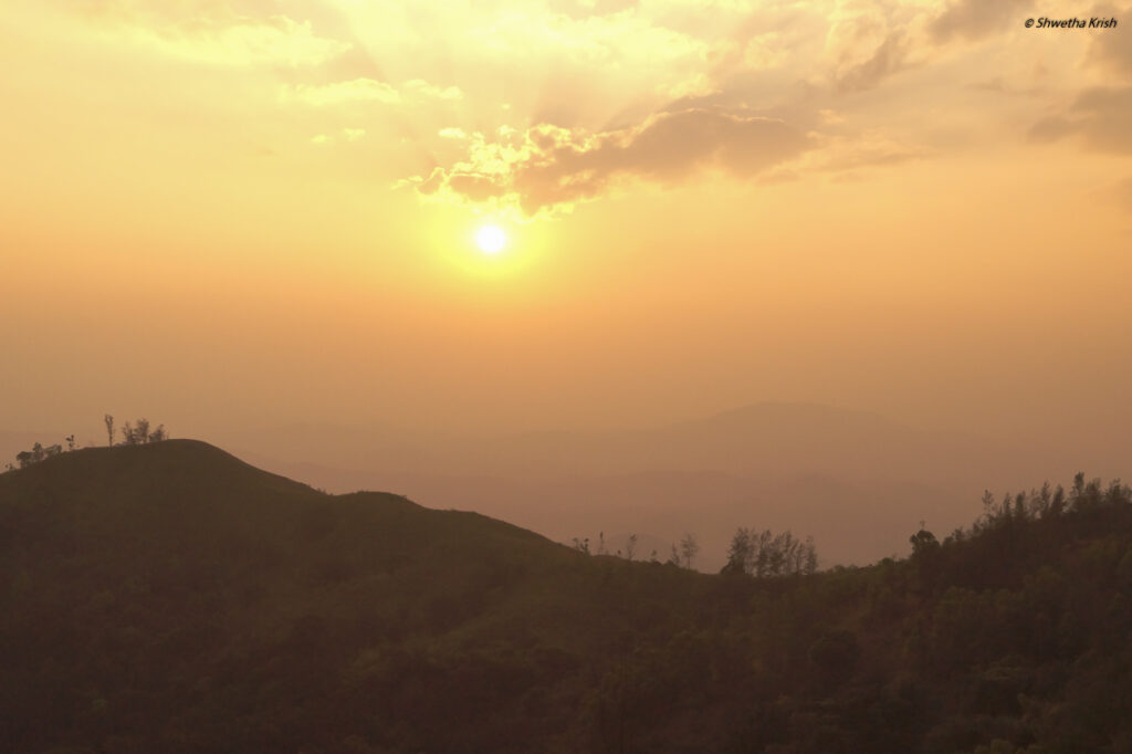
The trail starts on a Tar road right adjacent to the Kukke Subramanya temple and runs for 1.5 kms until it reaches the foothills of the forest. The trail initially runs through the thick forests. The ascent is steep and it takes considerable amount of time and energy to reach the grasslands. As the forests end, the grasslands begin, the Shesha Parvatha is clearly visible from this point. Beyond that is Kumara Parvatha hidden from view. As we walk through a winding path and move ahead, it leads to the Bhattara Mane on the left which is the only Oasis out here. Towards the right, the path leads to sunset view point and a little further ahead is the Forest Office.
One can stay at the Bhattara Mane who are the perfect hosts; hot sumptuous food, a small garden and a farm around the small cottage showcases the ingenuity of the place. Nowadays, one can stay in the dormitory at the Forest Office.
By early morning, Trekking permits and registration need to be acquired at the Forest Department Office which is close by to Bhattara mane.
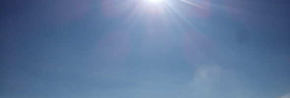
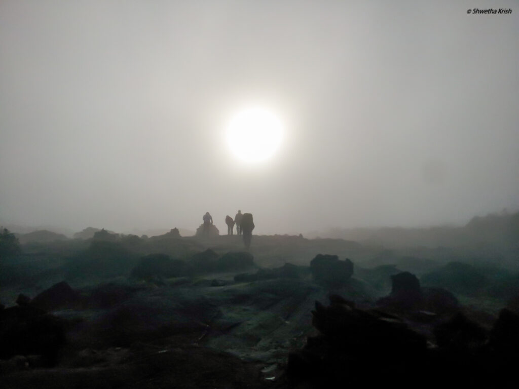
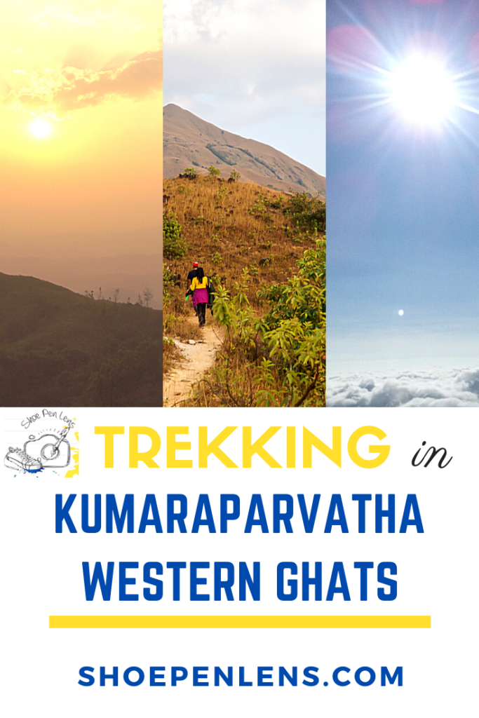
It is best to start early, say around 3 AM so that the blazing sun during the day can be avoided on the grasslands.
Phase II: Bhattara Mane to Kallu Mantapa (2.5 kms, 1.5 – 2.5 hrs)
Once the trek starts from the Forest Office, the trail is a steep ascent up the grasslands. A stone pillared structure comes into view and this is known as Kallu Mantapa where there is a small water source which can be made use of for drinking.
Phase III: Kallu Mantapa – Shesha Parvatha (3 kms, 2.5 – 3.5 hrs)
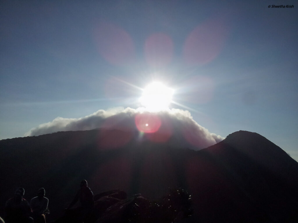
As the trail runs up the mountains, the glimpse of the sunrise and the surrounding mountain ranges give way for a beautiful spectacle. There is a rocky path and a loose gravel path. The rocky path seems a better option as it is steady. Further ahead a narrow trail runs along the mountain ridge. Altitude gain is much in this phase and the ascent is at 60-70 deg elevation. The path now leads to Shesha Parvatha where the mountain ranges look fabulous.
Phase IV: Shesha Parvatha – Kumara Parvatha (2 kms, 1-2 hrs)
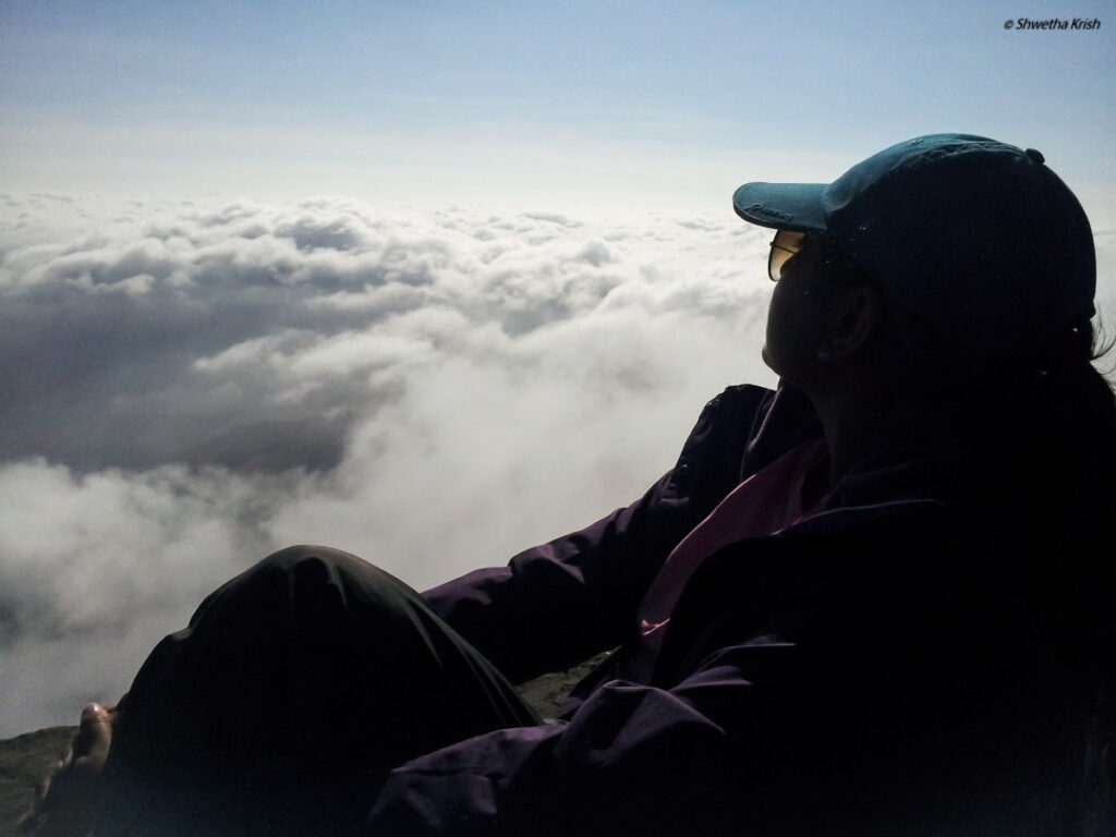
The path then leads to a small forest and a big rock. The huge boulder needs to be climbed cautiously and it is close to 90 deg. Once we go beyond this boulder we reach the last rocky terrain to the peak. There is a small Shiv Ling at the peak and the peak is an abode of marvelous views. To experience the floating clouds beneath us is a sight to behold.
The trek though challenging is worth it as the views at the peak is truly scenic and to embrace the clouds beneath you is a divine spectacle. The trek needs to be avoided in the summer months of Mar-May and also the monsoon months of Jun-Aug as it is either too hot during Summer or rainy and slippery during the Monsoons.
Physical fitness is a must for this trek as it happens to be the most difficult trek in South India.
Trek Stats:
- Elevation: 5617 ft (1712 m)
- Best seasons to Trek: Sep – Jan; Avoid going in the Monsoons
- Duration: 1-2 days depending on the pace. It is best to do it in 2 days owing to the difficulty level; 8-10 hours
- Trek Difficulty Level: Difficult
- Trek Distance: 13 kms (one way)
- Accommodation: Stay in Bhattara Mane or dormitory or tents near Forest Department office
- Location: 6 kms from Kukke Subramanya Temple, Dakshina Kannada District, Karnataka, India
- Nearest Train station: Kukke Subramanya (7 kms away)
- Nearest Airport: Mangalore Airport (86 kms away)
- By Road:
- Bangalore->Kukke Subramanya (280 kms)
- Mangalore->Kukke Subramanya (113 kms)
Things to pack /carry:
- Sturdy Backpack preferable with wider shoulder straps as it should sit comfortably on your shoulder
- Hiking Shoes and socks(leech socks if trekking during the monsoons)
- Water bottle / Water pack
- Cap
- Sunglasses
- Trekking pole
- Comfortable trekking pants and tees
- Light rain jacket /poncho depending on the season
- Light sweater depending on the weather
- Small first aid box
- Regular medication if any
- Head torch
- Sleeping bag
- A small notepad and pen
- Essentials: Wallet, ID card
- Mobile phone, chargers, powerbank
- Cameras and Batteries
KumaraParvatha is challenging trek but a beautiful one. Are you game for this?
Pingback: Trekking in Meesapulimalai and exploring Kollukumalai, Western Ghats - Shoe Pen Lens
Great post filled with useful info!
Thank you so much!
Oh my word, it sounds like a difficult trek. But I’m sure that view from above the clouds makes it well worth the effort!
Yes, it was a bit difficult but it was all worth it at the end!
Pingback: Trekking in Mullayanagiri, the highest peak in Karnataka - Shoe Pen Lens